Innovation soars in land surveying as we redefine accuracy, efficiency, and cost-effectiveness with cutting-edge drone technology. Specializing in aerial surveying, topographic mapping, and construction monitoring, our comprehensive solutions are tailored to meet diverse project needs. Experience the future of surveying with us and unlock new possibilities for your projects.

Phasellus rhoncus, dolor eget viverra pretium, dolor tellus aliquet nunc, tortor ultricies erat elit eu lacus. Vestibulum non justo consectetur, cursus ante eget, tincidunt sapien. Phasellus a augue vitae dui rhoncus accumsan. Donec amet odio et erat accumsan euismod ut at nisl.
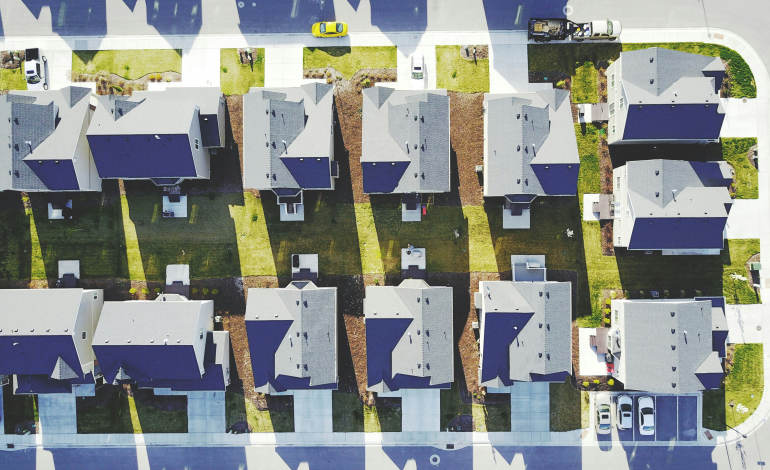
Transform your real estate marketing by delivering stunning aerial footage and 360-degree views that highlight properties from unique perspectives. This immersive imagery attracts potential buyers and showcases features that traditional photos or videos might miss. By offering a comprehensive view of the property and surrounding area, drones help agents and clients make informed decisions more efficiently.
——-
Rate: $225 per property. Includes 20 photos and 1 professionally edited video with background music.

Drones enhance property surveillance by providing real-time aerial views and detailed imagery that improve monitoring and security efforts. They can cover extensive areas quickly, capturing high-resolution footage that aids in detecting and addressing potential threats or maintenance issues. With advanced technology, drones offer a cost-effective solution for continuous oversight and rapid response.
——-
Rate: $125 per session. Includes 10 photos and 1 video of property.
Site Analysis: $200 per session. Includes 10 photos, 1 video, and analysis the property (e.g. changes, trespassers, damage, etc)
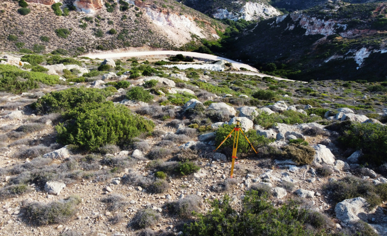
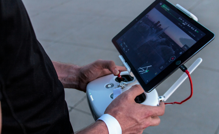
Drones revolutionize land surveying by offering high-resolution aerial imagery and precise topographic data with unprecedented speed and accuracy. They reduce the need for costly and time-consuming ground surveys, making large-scale and challenging terrains more accessible. Equipped with advanced sensors and GPS, drones provide real-time data that enhances decision-making and project planning.
——-
Rate: $200 per survey, includes photo with survey boundaries